|
Olympic Mapping Systems is a remote sensing and Digital photogrammetric mapping organization that provides clients with customized products and solutions to support a wide range of land-use and natural resource management activities.
Our top priority at Olympic Mapping Systems, Inc is to provide exemplary service and quality by focusing in exceeding the demand of our client and ensuring their complete satisfaction.
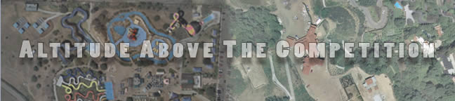
Map complitation from aierial photography on precision stereo plotting photogrammetric instruments has long been recognized as the most accurate, least expensive method of producing planimetric and topographic maps. Olympic Mapping Systems, with over 25 years of experience, offers a complete spectrum of photographic services, including:
Aerial Photography
Digital Aero-Triangulation
DIgital photogrammetric Mapping
Digital Topographic Mapping
Digital Stereo Digitizing
Plan and Profile Sheets
Orthophotography
Planimetric Mapping
Slope Analysis
|